By Ava Tien — updated 18 May 2026
I ran a regional Queensland survey business for six years before I joined Just Drones, and the question I got asked more than any other was: “Can I just use a Mavic for this?”
The honest answer is “sometimes.” The more useful answer is the one that helps you work out which side of the line your job lives on. This guide is the conversation I had with maybe 200 customers over those six years, written down once.
What “survey-grade” actually means
“Survey-grade” is one of the most abused phrases in commercial drone marketing. A real survey-grade aircraft delivers horizontal and vertical accuracy good enough that you can hand the deliverable to a registered surveyor and they can stamp it. In practice that means 2-3cm horizontal and 3-5cm vertical when paired with RTK ground correction or PPK post-processing.
Getting there reliably requires:
- An RTK-capable aircraft (DJI Phantom 4 RTK, Mavic 3 Enterprise RTK, Matrice 350 RTK, WingtraOne, etc.)
- A correction source (a base station you set up, a network correction service like CORSnet-NSW, or a known GCP grid)
- A photogrammetry processing pipeline (Pix4D, Agisoft Metashape, DroneDeploy, etc.)
- An operator who understands ground control points and how to validate the output
The aircraft is maybe 30% of the cost of doing this properly. The processing software and the operator’s time make up most of the rest.
What a prosumer drone (Mavic 3, Air 3, etc.) can actually do
A prosumer DJI — let’s use the Mavic 3 Pro as the benchmark since Marcus has flown the wheels off ours — can produce a perfectly usable orthomosaic at maybe 5-10cm horizontal accuracy if you fly it well, with good ground control points laid out on the site. That’s good enough for:
- Visual progress reporting on construction sites
- Property marketing for real estate listings
- Bushfire damage assessment
- Rough volumetric estimates for stockpiles where the margin of error is forgiving
- Insurance documentation
- Land subdivision proposals (for the discussion phase, not the cadastral lodgement)
It’s not good enough for:
- Cadastral surveys (you need a licensed surveyor and survey-grade gear)
- Engineering-grade volumetric calculations where dollars depend on the answer
- Detailed terrain modelling for civil works design
- Anything where 3-5cm vs 10cm makes a material difference
The honest middle ground: prosumer + GCPs
Most of my survey clients sat in the awkward middle where they needed better-than-Mavic accuracy but couldn’t justify a $25,000 Phantom 4 RTK. The workable answer was: a Mavic 3 Pro flown methodically, with 8-12 ground control points surveyed in by a borrowed total station or rented RTK rover, post-processed properly. You can get to about 5cm horizontal that way, and that’s enough for most jobs that aren’t lodging surveys at the Land Titles Office.
What you give up: time. A real survey-grade workflow on the Phantom 4 RTK lets you walk away from the site with deliverable-grade data after a single flight. The Mavic-plus-GCPs workflow involves a separate visit to lay and survey the GCPs, the flight, and a longer processing run. If you’re doing one site a month, the Mavic workflow is cheaper. If you’re doing one site a week, the dedicated RTK aircraft will pay for itself fast.
The actual aircraft worth considering in 2026
The commercial drone market in Australia narrowed considerably during 2024-25. Here is the honest current shortlist.
DJI Mavic 3 Multispectral / Mavic 3 Enterprise RTK
The Mavic 3 Enterprise RTK is the survey workhorse most small commercial operators end up buying. Around $9,500-$11,500 depending on the bundle. RTK module built in, mechanical shutter for ortho work, hot-swappable battery, real waypoint planning, and the DJI Pilot 2 app supports KMZ mission imports.
It is, in essence, the Mavic 3 Pro hardware with the bits that survey actually needs.
Check Mavic 3 Enterprise RTK on Amazon
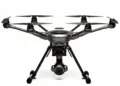
DJI Matrice 350 RTK
One tier up. Around $18,000 for the base aircraft, plus another $7,000-$12,000 in payloads (P1 camera for photogrammetry, L2 LiDAR for terrain, H30T for inspections). This is what you buy when you have committed to doing this as a real business, not a side hustle.
The M350 is overkill for most jobs but is the only DJI platform with the payload ecosystem to handle LiDAR. If your work touches forestry, powerline corridors, or anything where a true ground surface matters, this is where you end up.
WingtraOne Gen II
Fixed-wing VTOL. Used for large-area mapping (hundreds of hectares per flight). Around $25,000-$30,000 in Australia. Niche but unbeatable for big jobs — agricultural, environmental, large infrastructure corridors.
What’s no longer worth buying
The Phantom 4 RTK is end-of-life. DJI dropped firmware support and parts are getting hard to source. If you have one and it’s working, fine, run it into the ground. If you’re shopping for a survey-grade aircraft in 2026, the Mavic 3 Enterprise RTK is the right starting point.
The processing software question
The hardware is half the cost. The other half is the photogrammetry pipeline:
- Pix4D Mapper / Matic — the survey industry default. Around $4,000/year per seat. Best for serious survey deliverables.
- Agisoft Metashape — one-off perpetual license, $1,800 for the Standard edition or $5,400 for Pro. The Pro edition is what you need for georeferenced ortho.
- DroneDeploy — cloud-based, subscription. Good for site managers who want to look at the data, not for the surveyor who wants to dig into the point cloud.
- WebODM — open source. Free if your time is free. Slower, fewer hand-holds, perfectly capable for non-deliverable work.
Insurance and the certification question
If you’re charging money to fly — even one job — you need a Remote Operator’s Certificate (ReOC) from CASA, or you need to be flying under the “excluded RPA” category which has its own limits. The ReOC process is no longer the bureaucratic nightmare it was five years ago, but it isn’t free either: budget around $4,000-$8,000 for the full training and certification through a CASA-approved provider, plus ongoing currency requirements.
Public liability insurance is the other line item nobody mentions. Most commercial drone insurers in Australia want to see your ReOC, your aircraft serials, and a flight log before they’ll write a policy. Expect $1,500-$3,000/year for $20M coverage on a small commercial operation.
The decision framework
If you’re trying to decide whether to buy a Mavic 3 Pro or save up for a Mavic 3 Enterprise RTK, ask yourself three questions:
- Will any client ever ask “is this survey grade?” If yes, you need RTK.
- Is your data ever going to be used to spend more than $50,000 of someone else’s money? If yes, you need RTK.
- Are you billing more than one job a month? If yes, the time you save with proper RTK kit will pay for the aircraft within 18 months.
If all three answers are no, run a Mavic 3 Pro with a discipline around GCPs and get good at the workflow. Then upgrade when the work justifies it.
What to read next
- CASA drone rules in Australia — the 2026 update (the regulatory side)
- DJI Mavic 3 Pro — the long-term review (the prosumer benchmark)
- How to register your drone with CASA
Got a specific commercial use case you’re trying to scope? Email me directly: [email protected]. I’m happy to talk through whether your project actually needs RTK or whether you’re over-spec-ing.