Drones & 3D Mapping
The preservation of historic buildings is important. Lunan Bay, a popular tourist destination for its spectacular red castle is on the verge of collapse. Following centuries of wear from history and the sea. Skykam Drone Services used this to demonstrate our 3D mapping services. We set out to create an automated aerial 3d map that can be measured down to centimetre accuracy, in order to preserve this architectural wonder before it’s too late! Providing conservationists with a baseline accurate 3d model, which future deterioration can be measured against.
What is a 3D Mapping Drone?
3D Mapping using drones is a new technology that has been quickly gaining popularity in recent years. They allow us to capture pinpoint accurate 3d maps, which provides for a better understanding of an environment and can help plan out specific routes or areas where certain obstacles might be found during initial planning or maintenance.
If you are looking to have peace of mind when building out your home or business, then 3d mapping drones may just be the technology for you. These aerial vehicles capture pinpoint accurate three-dimensional maps that can provide an understanding of what is going on in any given environment, which will help future construction plans go much smoother!
Why is 3D Mapping so beneficial to historic sites?
3D Mapping is a technique for the creation and inspection of detailed, virtual representations. These assessments can be used by archaeologists to measure historic landmarks for documentation. This can then be used as a baseline to measure against for future inspections. Conservationists can use these 3D aerial surveys to find areas that could cause problems in the future, This allows conservationists to measure wear, damage, looking for areas that may cause an issue in the future – saving not just time but also resources like money spent on repairs or prevent irreversible damage.
Using Drone Surveys to bring history to life
3D mapping drones offer an amazing way to preserve and share the world’s historic sites with 3-dimensional models. These accurate models can be used in tours, apps for mobile devices or even real life! This is because our drones capture data using laser scanning technology which creates incredibly detailed measurements of structures so no one will ever forget what was here before us – it’ll always remain intact through generation’s too; all thanks to drone technology.
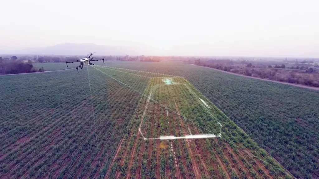
How does a 3D mapping drone work?
The drone flies a GPS-directed flight in the grid pattern, snapping pictures at regular intervals. This process takes only minutes depending on location size. Then our industry-standard 3D-Mapping software turns these images into an accurate map model of your building or site for future reference!
The advantages of drones in protecting our heritage?
Drone Surveying is the future of 3d mapping and conservation, as our Red Castle demonstration provides an excellent example. Drones give us a bird’s-eye view not possible before while creating accurate measurements that are measurable with great detail! As we became more aware of environmental damage to historic locations like The Red Castle; Thanks to these flying robots they can be preserved, drones make it easier than ever before to capture how something was original – by using drones they can be preserved for generations yet to come!
Lunan Bay’s red castle is a popular tourist destination. It once hosted royal weddings, but now it is on the verge of collapse. 3D mapping drones offer an amazing way to preserve and share the world’s historic sites with 3-dimensional models in high resolution for all to experience when they can’t visit in person. What other landmarks or historical sites would you like to see preserved this way? Let us know your thoughts!
The following guest post was written by James Leslie, Founder of Skykam. Skykam is an Edinburgh based drone service.

