I recently attended the Emerald Cup, a large two-day gathering of the California cannabis industry. Tens of thousands of participants, growers, associations, and grow-related businesses descended on the Sonoma County fairgrounds in Santa Rosa to celebrate the 2017 fall harvest.
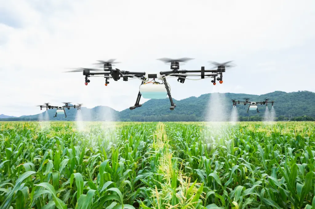
Let me preface that my weed-smoking days are long behind me. I went to the Emerald Cup to better understand the role of drones in cannabis production. My company, Drone Scholars, specializes on drone data for vegetation mapping. Drones are powerful tools for precision agriculture and are increasingly being used in agri-business. Drone data are particularly relevant for high-value crops grown at smaller spatial scales, such as vineyards, berries, and possibly cannabis.

With lightening regulations, the commercial drone industry is starting to take off and so is legal cannabis. (Insert joke here about both getting you high). In a matter of days, recreational pot use will be allowed in the state of California, one of the largest economies in the world. What were small guerilla-gardens in the remote corners of Humboldt or Mendocino counties will shift to the landscape of the Central Valley, one of the most productive agricultural regions in the world. The economic implications of this are considerable.
As I walked down the vendor aisles at the Emerald Cup, I was impressed by the ability to do some serious plant science. Note that my PhD is in ecology, so I geek out on these things. There were genomics labs that will sequence your cannabis strains, providing estimates of genetic distance for intellectual property. There were plant chemistry labs that will test your product for dozens of different compounds (namely cannabinoids and other terpenes). There were other tests available for pathogens, such as powdery mildew. Still other companies were interested in soil science and microbial diversity. These are all the right ingredients for a really interesting R&D program within which drones would be a useful component.
I didn’t see any cannabis-related drone companies, but there were clear opportunities in several key areas of the market:
Cannabis Insurance: A variety of cannabis insurance startups are popping up. As with drones, I suspect major insurance companies remain hesitant to enter this emerging market. My impression is that current cannabis insurance policies are mainly for commercial liability (buildings, equipment, and workers), not crop insurance per se. Drones are already proving themselves in the traditional insurance industry through high-resolution aerial imagery for risk assessment and claim processing. Cannabis insurance would similarly benefit from these added data layers.
State Licensing and Taxation: The decision to legalize cannabis has created a daunting task for states to establish regulatory frameworks and licensing infrastructure. Drones offer a rapid assessment tool for outdoor grows. High-resolution (< 1 cm per pixel) maps could be collected quickly and efficiently for both licensing and enforcement. Machine learning could be used to automate image analysis for stands counts and plant cover estimates. This could all be done with today’s drone hardware and software, at a low cost, and with much higher accuracy than visual observers on the ground. Drones, weed, and artificial intelligence…those should be enough buzzwords to interest a venture capitalist somewhere.
Precision Agriculture: From a plant science perspective, the most interesting aspect of drones is in monitoring cannabis production from seedling to harvest. To date, remote sensing has been primarily used for identifying illicit operations using manned aircraft or satellites (illegal grows on public lands can have significant environmental impacts). I am sure there have already been drone flights over gardens using low-cost consumer drones, but it is in the data interpretation where the work is to be done. Unlike other high value crops, we know little about how multispectral imagery correlates with different aspects of cannabis health, chemical content, and production. Moreover, how do these relationships vary in space and time? There is a lot of research ground to be made up.
Experimental test plots are needed that incorporate multi-factorial statistical designs, systematically varying different management regimes with replication. These variables could include different genotypes, fertilization treatments, irrigation levels, pesticides applications, and more. Repeated drone surveys throughout the growing season could then be used to compare the relationships between imagery and plant trait measurements. Ultimately, drones will only be useful for cannabis production if the imagery can predict problems early on, more precisely manage inputs, replace costly lab testing, or speed up labor-intensive field practices. While the return on investment remains to be seen, I suspect interesting patterns would emerge.
Some conclusions: It is still very early days in the legal cannabis market. Perhaps too early for drones and precision agriculture, but not too early to start the discussion. Cannabis growers need to be at the point where they are investing in research infrastructure and test plots that could be flown. Grow operations need to be large enough to warrant aerial surveys that might save time and money. There needs to be less hesitation to allow geo-referenced datasets to be collected (I suspect this will come with legalization).
One thing is certain, the potential for drones and weed is there and it is definitely not boring.


